£119.99
Remote Sensing for Characterization of Geohazards and Natural Resources

Overview
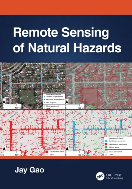
This book provides insights from a geoscientist’s perspective into the benefits and the potential of remote sensing methods to address problems with a high social impact: identifying the drivers of geohazards and developing new methods for monitoring natural resources. The fields covered include volcanic hazards, seismic hazards, landslide hazards, land subsidence hazards and monitoring of natural resources through the use and combination of various remote sensing techniques and modelling approaches. This book should spark collaborations and encourage readers to think beyond disciplines or techniques, as well as enable readers to build their own workflow depending on their study of interest. It provides a much-needed comprehensive review of recent advances that remote sensing methods have brought to geohazards and resources research. It is unique in the way that it unifies geohazards and natural resources research to highlight cross-field advancements and potential areas for multiple fields of science to collaborate.
Purpose and Audience
The book intends to provide both a basic understanding of the remote sensing methods used in geohazards and natural resources sciences, with appropriate referencing for readers wishing to further their technique-specific learning, and a detailed application of these methods to a variety of sustainability problems. It aims at providing the reader with workflows for combining multiple techniques with demonstrated results in a variety of disciplines. This approach makes the book useful for both students learning about geohazards and resources, learning about remote sensing methods, and for researchers intending to expand their skill set using methods that have been applied to other fields. This book provides an introduction to each remote sensing method with references for in-depth technical learning which will benefit students in Remote Sensing courses.